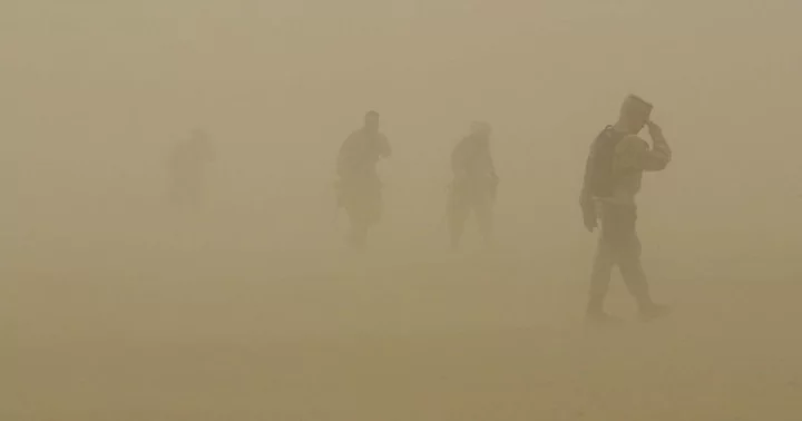
SAHARA DESERT, AFRICA: A massive dust cloud from the Sahara Desert is making its way across the Atlantic to the United States after covering a distance of over 5,000 miles and it poses potential challenges. Experts have raised concerns that this dust cloud could bring extreme heat and impact air quality in five southeastern states.
Skies over Florida, as well as parts of Texas, Louisiana, Alabama, and Mississippi, may appear hazy and could even turn brown as the dust cloud is expected to linger over the weekend. AccuWeather is actively monitoring several large dust clouds originating from Africa's blistering-hot desert, and they warn that even larger plumes are expected to arrive next week.
What is the Saharan Air Layer?
This dust cloud, known as the Saharan Air Layer, is described by experts as "a mass of very dry, dusty air that forms over the Sahara Desert during the late spring, summer, and early fall." When combined with strong jet streams, like the ones currently moving across the Atlantic towards the southeastern coast of the US, these plumes can travel thousands of miles.
These immense clouds are predicted to cross the entire Atlantic Ocean before reaching Florida, the Caribbean, and parts of Texas, Louisiana, Alabama, and Mississippi. "It may look a little hazy in cities like Tampa, Orlando and Miami as some of that drier air comes in," Accuweather forecaster Bernie Rayno warned. On Thursday, July 6, the National Oceanic and Atmospheric Administration (NOAA) weather satellite captured the first cloud over the eastern Caribbean Sea and the Lesser Antilles.
A larger Saharan dust plume expected next week
Additionally, a larger plume is currently emerging on the African coast and is expected to arrive next week. The dense dust particles in the Saharan Air Layer interact with light, leading to daytime haze and creating stunning pink and orange sunsets. Moreover, the dry Saharan air, which is 50% drier than the typical Floridian atmosphere, can inhibit the formation of storms by impeding cloud development. Currently, Florida is under a heat advisory, with meteorologists warning that temperatures could reach as high as 109 degrees Fahrenheit on Saturday. The presence of the drifting dust can also trigger allergy-like symptoms such as coughing and sneezing.
According to the National Oceanic and Atmospheric Administration (NOAA), outbreaks of the Saharan Air Layer typically occupy a 2 to 2.5-mile-thick layer of the atmosphere, with the base starting approximately 1 mile above the surface. While the arrival of the Saharan dust cloud may impact air quality, it is not expected to have as severe an effect as the recent Canadian wildfires, which have intermittently caused air quality issues on the East Coast, including New York City, throughout the summer.
As of Wednesday, there were 639 active fires burning in Canada with 351 of them classified as out of control, according to Michael Norton, the director general at the Northern Forestry Centre, Canadian Forest Service. This year, there have already been 3,412 fires in Canada, surpassing the 10-year average of 2,751. The Canadian wildfires have broken records in terms of total burned area, the number of evacuations, and firefighting costs. Officials warn that the fire season is only halfway through, indicating the potential for further challenges.
In contrast, Florida's air quality is currently rated as good in most areas, according to the state's Department of Environmental Protection, indicating low levels of particulate matter in the air. The Air Quality Index (AQI) ratings, which range from 0 to 500, are currently mostly under 50 across the state, qualifying as good. However, the incoming Saharan dust plume could cause a slight increase in AQI, pushing it slightly above 50, which falls under the moderate category.
