A developing coastal storm will bring gusty winds, heavy rain, dangerous rip currents and coastal flooding from Florida to New England as it tracks along the East Coast into this weekend.
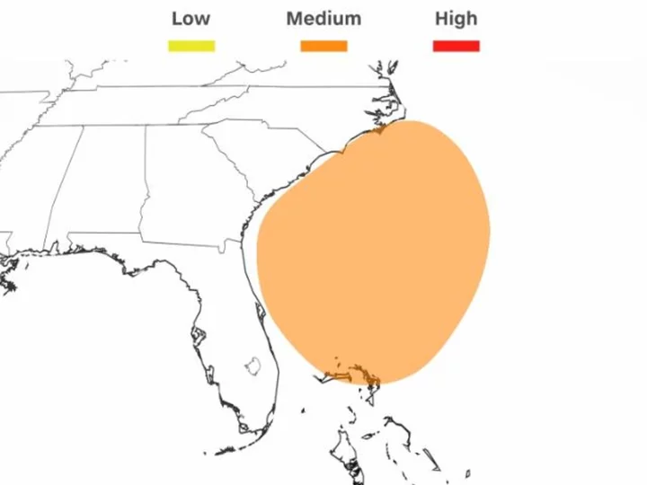
An area of low pressure is likely to develop off the east coast of Florida by early Friday. If conditions are just right, this low pressure could even develop enough to be named by the National Hurricane Center.
The next two Atlantic storm names are Ophelia and Philippe.
There is a 40 percent chance this area of low pressure organizes into a subtropical storm into the weekend, according to the hurricane center. A subtropical storm is a cyclone that is not fully tropical, but still has some characteristics found in a tropical storm.
But the difference in overall impacts between the two are minimal, as subtropical storms still produce strong winds and can spread heavy rain well away from the storm's center. The storm's impacts to a wide swath of the Eastern Seaboard will also be the same, regardless of whether it is named.
And tropical storm conditions -- wind gusts greater than 35 mph and heavy rain -- are most likely along the coast from North Carolina to southern New Jersey.
Rain and thunderstorms are likely to soak parts of Florida's northeast coast Thursday as the storm slowly comes together. Breezy conditions will also develop on Thursday and churn up surf along the Florida and Georgia coast.
As the coastal storm becomes more organized on Friday, rainfall will shift north and eastward into parts of the Carolinas and Virginia.
The greatest risk for heavy rain is expected in eastern North Carolina, where the National Weather Service in Morehead City warned that rainfall from Friday through weekend could be substantial, with widespread totals of 4 to 6 inches likely in the far eastern portion of the state. Prolonged, heavy rain could cause flooding, especially in low-lying or poor drainage areas.
Wind speeds will also increase on Friday, gusting 30 to 40 mph in coastal areas from the Carolinas north to Delaware. These wind gusts, coupled with soaked ground, may bring down trees, which could cause property damage and power outages.
Rain from the coastal storm will stretch hundreds of miles from its center and drench portions of the mid-Atlantic during the day Saturday and even parts of New England by Saturday night. The heaviest rainfall will continue to remain largely confined to areas close to the coast, but inland areas will still have to deal with stormy weather which could disrupt outdoor plans.
As the storm treks north, the risk for dangerous rip currents will be elevated along much of the East Coast as it churns up hazardous seas. The weather service warned of a high risk for rip currents headed into the weekend for sections of the coastline from Florida to New Jersey.
Coastal flooding is also possible as the storm moves up the coast this weekend. Strong winds can pile up water at the coast for portions of North Carolina northward into New Jersey.