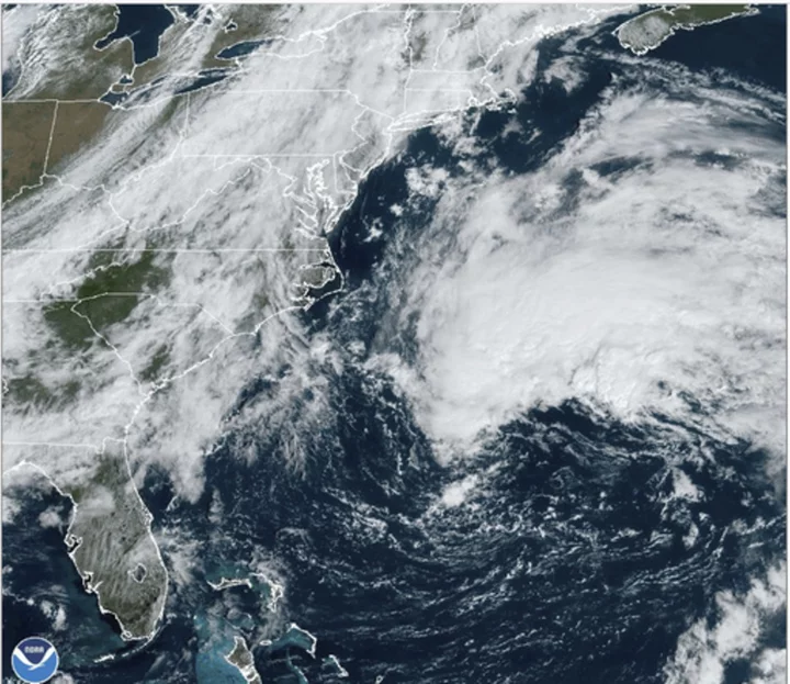
The remnants of former Tropical Storm Philippe headed toward waterlogged New England with the promise of more precipitation, gusts and isolated power outages after lashing Bermuda with heavy rain and winds.
The storm was expected to arrive late Saturday with gusts up to 50 mph (80 kph) in eastern and northern Maine, strong enough to cause power outages, along with 1 to 4 inches (2.5 to 10 centimeters) of rain over a broader area in a state where the ground is already saturated from previous rain, said Anne Strauser, a meteorologist with the National Weather Service in Maine.
Down East Maine and Atlantic Canada were expected to bear the storm's brunt just three weeks after being hit by Tropical Storm Lee.
Philippe, now a low pressure system, no longer a tropical storm, should be milder but will still pack a punch.
The National Weather Service in Gray, Maine, said a high surf advisory was in effect for Sunday from 6 a.m. to 6 p.m. with waves from 6 to 10 feet (1.8 to 3 meters) on the Maine coast including York, Cumberland, Sagadahoc, Lincoln, Knox and Waldo counties and on the New Hampshire coast in Rockingham County.
The dreary forecast meant another washout for many in New England, which already dealt with heavy rain, powerful thunderstorms, flash flooding and even tornadoes in the past month. Maine’s largest city, Portland, experienced the second-wettest summer in terms of rainy days. June and July were especially brutal with rainfall during six out of eight weekends during that stretch.
Boaters, beachgoers, hikers, campers and others who enjoy the outdoors have lamented the wet weather.
“The weather is a big topic of conversation, mostly about how poor it’s been,” said Vanessa Donnelly, general manager of Four Points Marina, which has 150 boat slips in Portland Harbor. Rainy weather has slowed boating activity, she said.
Philippe made landfall in Barbuda late Monday while drenching the northeast Caribbean, downing trees and power lines in a handful of islands.
The storm lost some steam after hitting Bermuda on Friday and heading northward into colder waters.
Meanwhile, Tropical Storm Lidia swirled through open waters in the Pacific on Friday night. A National Hurricane Center update at 11 p.m. EST said the storm was located about 515 miles (825 kilometers) west-southwest of Manzanillo, Mexico, and about 460 miles (745 kilometers) south-southwest of the southern tip of Baja California with maximum sustained winds of up to 70 mph (110 kph).
Lidia was moving west at 6 mph (9 kph) but expected to turn northwest and north over the weekend. Surf swells will begin affecting the west coast of Mexico and the Baja peninsula in California on Saturday, the center said.


